 |
SEALEVEL STATION CATALOG (SSC) |
|
|
|
|
|
| Station catalog metadata [edit] | [station overview] |
|---|
| SSC ID | SSC-zeeb | | Station Name | Zeebrugge | | Country | Belgium | | Latitude | 51.35 | | Longitude | 3.2 | | DateLastModified | 2015-10-22 19:02:29 |
| Distributed metadata source: IOC Sea Level Station Monitoring Facility zldw |
|---|
| Status | Operational |
| Local Contact | Maritieme Dienstverlening en Kust ( Belgium ) |
| Connection | WEB service |
| Country | Belgium |
| Sensor 1 | |
| Type of sensor | bub |
| Sampling rate (min) | 5 |
| Distributed metadata source: PSMSL |
| Name | ZEEBRUGGE |
| SONEL id | 2990 |
| Is RLR | Y |
| Has RLR Diagram | Y link |
| QC Flag | N |
| Old ID | 160/011 |
| Last Updated | 2025-01-15 |
| Supplier | AGENCY FOR MARITIME AND COASTAL SERVICES |
| Address | Agency for Maritime and Coastal Services, Flemish Hydrography, Vrijhavenstraat 3, 8400 Oostende, BELGIUM |
| Metric Start | 1942 |
| Metric End | 2024 |
| Metric Completeness | 74.5 |
| RLR Start | 1942 |
| RLR End | 2024 |
| RLR Completeness | 74.5 |
| Download metric sea level data. | Use only with extreme caution. |
IOC Sea Level Station Monitoring Facility - realtime graph for 'zldw' 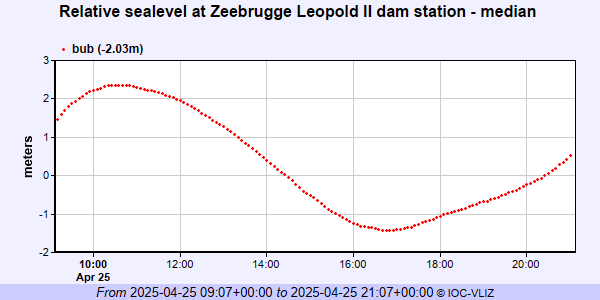 PSMSL Annual Mean Sea Level for '470' 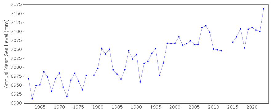 PSMSL Monthly Mean Sea Level for '470' 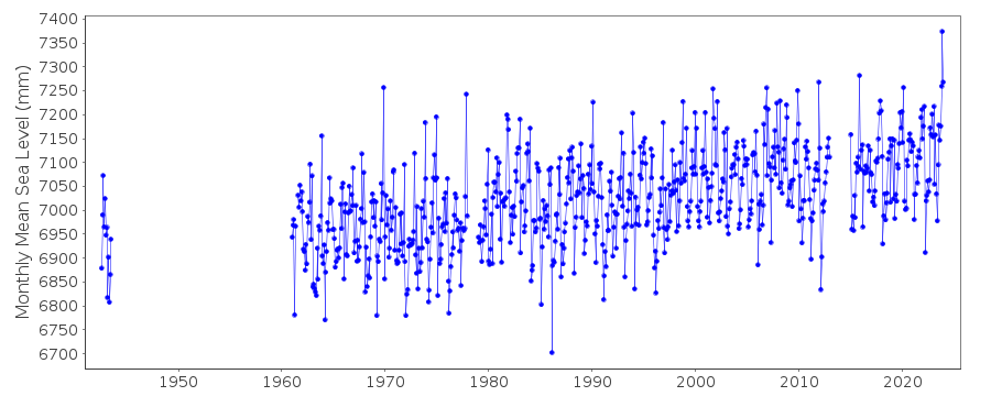
|
|
|