 |
SEALEVEL STATION CATALOG (SSC) |
|
|
|
|
|
| Station catalog metadata [edit] | [station overview] |
|---|
| SSC ID | SSC-waji | | Station Name | Wajima | | Country | Japan | | Latitude | 37.405833 | | Longitude | 136.900278 | | DateLastModified | 2015-10-22 19:02:29 |
| Distributed metadata source: PSMSL |
| Name | WAJIMA |
| SONEL id | 782 |
| Is RLR | Y |
| Has RLR Diagram | Y link |
| QC Flag | N |
| Old ID | 647/071 |
| Last Updated | 2024-03-04 |
| Supplier | GEOGRAPHICAL SURVEY INSTITUTE |
| Address | Geographical Survey Institute, Kitasato -1, Tsukuba-shi, Ibaraki-ken 305, JAPAN |
| Metric Start | 1900 |
| Metric End | 2023 |
| Metric Completeness | 98.7 |
| RLR Start | 1930 |
| RLR End | 2023 |
| RLR Completeness | 98.3 |
| Download metric sea level data. | Use only with extreme caution. |
PSMSL Annual Mean Sea Level for '132' 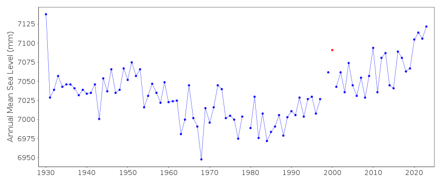 PSMSL Monthly Mean Sea Level for '132' 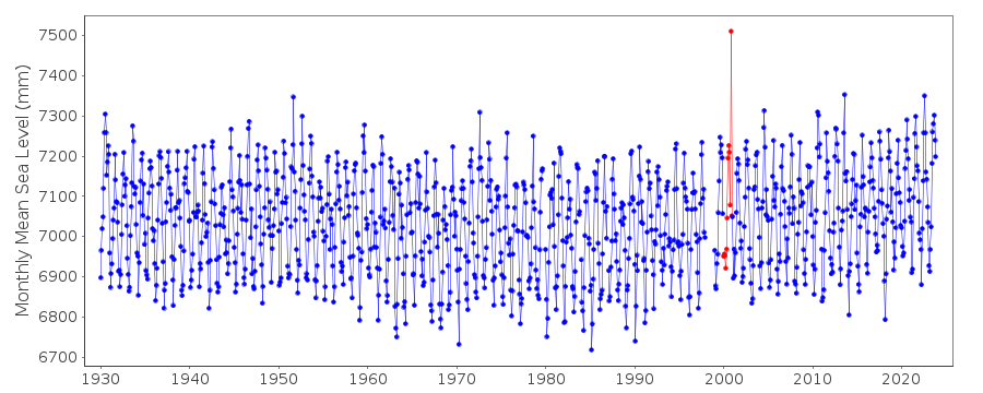
|
|
|