 |
SEALEVEL STATION CATALOG (SSC) |
|
|
|
|
|
| Station catalog metadata [edit] | [station overview] |
|---|
| SSC ID | SSC-vlis | | Station Name | Vlissingen | | Country | Netherlands | | Latitude | 51.442222 | | Longitude | 3.596111 | | DateLastModified | 2015-10-22 19:02:29 |
| Linked codes |
|---|
| Codes | Location | Latitude | Longitude | Sensors | IOC: vlis | Vlissingen | 51.4428582528 | 3.59700864658 | flt |
PSMSL: 20 | VLISSINGEN | 51.442222 | 3.596111 | N/A |
SONEL_GPS: 2240 | VLISSINGEN | 51.44286200 | 3.59734100 | N/A |
SONEL_TG: 2239 | VLISSINGEN | 51.44286200 | 3.59734100 | N/A |
| Distributed metadata source: IOC Sea Level Station Monitoring Facility vlis |
|---|
| Status | Operational |
| Local Contact | Rijkswaterstaat ( Netherlands ) |
| Connection | WEB service |
| Country | Netherlands |
| Sensor 1 | |
| Type of sensor | flt |
| Sampling rate (min) | 10 |
| Distributed metadata source: PSMSL |
| Name | VLISSINGEN |
| SONEL id | 2240 |
| Is RLR | Y |
| Has RLR Diagram | Y link |
| QC Flag | N |
| Old ID | 150/101 |
| Last Updated | 2025-11-14 |
| Supplier | RIJKSWATERSTAAT |
| Address | Servicedesk Data, Rijkswaterstaat, Postbus 556, 3000 AN Rotterdam , NETHERLANDS, KINGDOM OF THE |
| Metric Start | 1862 |
| Metric End | 2024 |
| Metric Completeness | 100.0 |
| RLR Start | 1862 |
| RLR End | 2024 |
| RLR Completeness | 100.0 |
| Download metric sea level data. | Use only with extreme caution. |
IOC Sea Level Station Monitoring Facility - realtime graph for 'vlis' 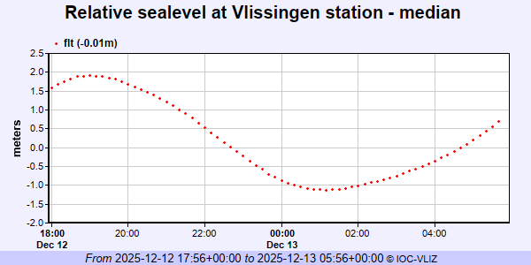 PSMSL Annual Mean Sea Level for '20' 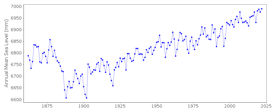 PSMSL Monthly Mean Sea Level for '20' 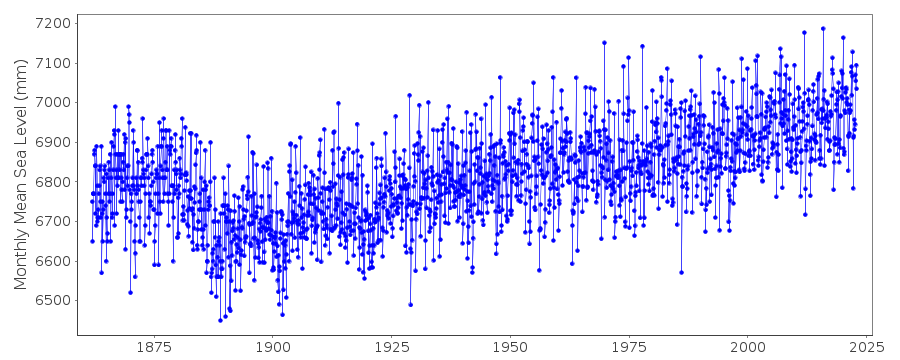
|
|
|