 |
SEALEVEL STATION CATALOG (SSC) |
|
|
|
|
|
| Station catalog metadata [edit] | [station overview] |
|---|
| SSC ID | SSC-pter | | Station Name | Port Erin | | Country | Isle of Man | | Latitude | 54.085389 | | Longitude | -4.768056 | | DateLastModified | 2015-10-22 19:11:29 |
| Linked codes |
|---|
| Codes | Location | Latitude | Longitude | Sensors | PSMSL: 1793 | PORT ERIN | 54.085389 | -4.768056 | N/A |
| Distributed metadata source: PSMSL |
| Name | PORT ERIN |
| SONEL id | 4323 |
| Is RLR | Y |
| Has RLR Diagram | Y link |
| QC Flag | N |
| Old ID | 170/233 |
| Last Updated | 2026-02-19 |
| Supplier | ENVIRONMENT AGENCY |
| Address | Environment Agency, Horizon House, Deanery Road, BS1 5AH, Bristol, UNITED KINGDOM |
| Metric Start | 1992 |
| Metric End | 2025 |
| Metric Completeness | 88.7 |
| RLR Start | 1992 |
| RLR End | 2025 |
| RLR Completeness | 71.8 |
| Download metric sea level data. | Use only with extreme caution. |
PSMSL Annual Mean Sea Level for '1793' 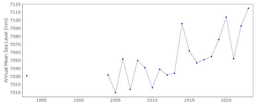 PSMSL Monthly Mean Sea Level for '1793' 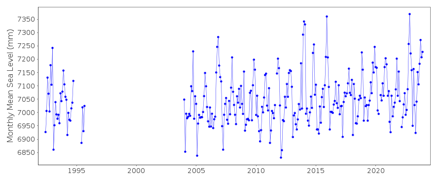
|
|
|