 |
SEALEVEL STATION CATALOG (SSC) |
|
|
|
|
|
| Station catalog metadata [edit] | [station overview] |
|---|
| SSC ID | SSC-pira | | Station Name | Piramide | | Country | Argentina | | Latitude | -42.583333 | | Longitude | -64.283333 | | DateLastModified | 2015-10-22 19:02:29 |
| Linked codes |
|---|
| Codes | Location | Latitude | Longitude | Sensors | PSMSL: 867 | PIRAMIDE | -42.583333 | -64.283333 | N/A |
| Distributed metadata source: PSMSL |
| Name | PIRAMIDE |
| Is RLR | Y |
| Has RLR Diagram | Y link |
| QC Flag | N |
| Old ID | 860/041 |
| Last Updated | null |
| Supplier | SERVICIO DE HIDROGRAFIA NAVAL, ARGENTINA |
| Address | Servicio de Hidrografia Naval, Departmento Oceanografia, Av. Montes de Oca 2124, 1271 Buenos Aires, ARGENTINA |
| Metric Start | 1957 |
| Metric End | 1972 |
| Metric Completeness | 95.3 |
| RLR Start | 1957 |
| RLR End | 1972 |
| RLR Completeness | 95.3 |
| Download metric sea level data. | Use only with extreme caution. |
PSMSL Annual Mean Sea Level for '867'  PSMSL Monthly Mean Sea Level for '867' 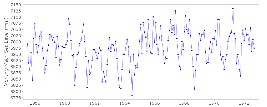
|
|
|