 |
SEALEVEL STATION CATALOG (SSC) |
|
|
|
|
|
| Station catalog metadata [edit] | [station overview] |
|---|
| SSC ID | SSC-nevl | | Station Name | Nevlunghavn | | Country | Norway | | Latitude | 58.966667 | | Longitude | 9.883333 | | DateLastModified | 2015-10-22 19:02:29 |
| Linked codes |
|---|
| Codes | Location | Latitude | Longitude | Sensors | PSMSL: 401 | NEVLUNGHAVN | 58.966667 | 9.883333 | N/A |
| Distributed metadata source: PSMSL |
| Name | NEVLUNGHAVN |
| Is RLR | Y |
| Has RLR Diagram | Y link |
| QC Flag | N |
| Old ID | 040/311 |
| Last Updated | null |
| Supplier | STATENS KARTVERK |
| Address | Statens Kartverk, Geodesidivisjonen, 3500 Honefoss, NORWAY |
| Metric Start | 1935 |
| Metric End | 1965 |
| Metric Completeness | 93.0 |
| RLR Start | 1935 |
| RLR End | 1965 |
| RLR Completeness | 93.0 |
| Download metric sea level data. | Use only with extreme caution. |
PSMSL Annual Mean Sea Level for '401' 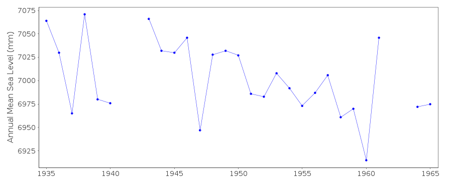 PSMSL Monthly Mean Sea Level for '401' 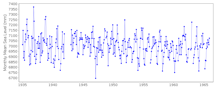
|
|
|