 |
SEALEVEL STATION CATALOG (SSC) |
|
|
|
|
|
| Station catalog metadata [edit] | [station overview] |
|---|
| SSC ID | SSC-naur | | Station Name | Nauru | | Country | Nauru | | Latitude | -0.52 | | Longitude | 166.91 | | DateLastModified | 2015-10-22 19:02:29 |
| Distributed metadata source: IOC Sea Level Station Monitoring Facility naur |
|---|
| GTS station code | 91531 |
| GTS message type | SXPS86 |
| Status | Down |
| Other Contact | Japan Meteorological Agency ( Japan ) |
| Connection | GTS message |
| Country | Nauru |
| Sensor 1 | |
| Type of sensor | rad |
| Sampling rate (min) | 6 |
| Distributed metadata source: IOC Sea Level Station Monitoring Facility nauu |
|---|
| GTS station code | 67640 |
| GTS message type | SZPS01 |
| Status | Operational |
| Local Contact | National Tidal Centre/Australian Bureau of Meteorology ( Australia ) |
| Connection | GTS message |
| Country | Nauru |
| Sensor 1 | |
| Type of sensor | prs |
| Sampling rate (min) | 1 |
| Distributed metadata source: GLOSS Station Handbook |
|---|
| Time Zone | 180E, GMT + 12hrs | | Ocean | Pacific | | Operational | Yes | | Tide gauge benchmarks | UH-1: recessed triangle (steel pin is rusted away), no stamp, located 2ft E of tide well and 1ft from edge of quay (established 01 May 1974) | | Benchmark relationships | Datum for levelling is zero of the tide staff established in 1988.
Datum is 3.826m below UH-1 (Oct 1989)
Datum is 3.595m below UH-2B (Oct 1989)
Datum is 6.483m below UH-3B (Oct 1989)
| | Auxiliary benchmarks | UH-2B: 0.5 inch hex head SS screw set in epoxy with 'BM2B' written in cement, located near crane warehouse wall below harbour masters office.
UH-3B: 0.5 inch hex head bolt set in epoxy with 'BM3B' written in cement located on upper curb of Queen's Landing, 50ft S of habour master house.
UH-6A: 3/8 inch brass, located on left side of red door, it is the right hand pin of pair.
(UH-2B, UH-3B established Aug 1983, UH-6A - Oct. 1989)
| | Other relevant information | Backup gauges on site:
1) Leupold and Stevens (October 1985-)
2) Handar encoder (February 1984-)
Daily values calculated using 119-point convolution filter (Bloomfield, 1976) centred on noon applied to the hourly data with respective periods of the 95, 50 and 5% amplitude points at 124.0, 60.2 and 40.2 hours.
| | Other relevant codes | UHSLC 004 |
| Distributed metadata source: PTWC COMP META file |
| DCP ID | 67640 |
| WMO | SZPS01 |
| Samp Rate | 1 |
| Num# Samp | 6 |
| Unit | M |
| Scale | 1.0000 |
| Xmt Int. | 003 |
| Fst Min. | 0000 |
| HAR | 1 |
| Owner | ABM |
| Distributed metadata source: UHSLC |
| UHSLC id | 004 |
| SSC id | naur |
| GLOSS id | 114 |
| UHSLC geojson | https://uhslc.soest.hawaii.edu/data/meta.geojson |
| Research quality data version a | 1974-05-07 - 1995-01-04 |
| Research quality data version b | 1993-07-08 - 2021-12-31 |
| RQ basin | pacific |
| Fast delivery | 1993-07-08 - 2026-05-31 |
| Distributed metadata source: PSMSL |
| Name | NAURU |
| GLOSS id | 114 |
| UHSLC ID | 4 |
| SONEL id | 750 |
| Is RLR | Y |
| Has RLR Diagram | Y link |
| QC Flag | N |
| Old ID | 715/001 |
| Last Updated | 1996-02-14 |
| Supplier | UNIVERSITY OF HAWAII SEA LEVEL CENTER |
| Address | University of Hawaii Sea Level Center, Department of Oceanography Division of Natural Sciences, 1000 Pope Road, Honolulu, Hawaii 96822, UNITED STATES |
| Metric Start | 1974 |
| Metric End | 1994 |
| Metric Completeness | 91.3 |
| RLR Start | 1974 |
| RLR End | 1994 |
| RLR Completeness | 91.3 |
| Download metric sea level data. | Use only with extreme caution. |
| Name | NAURU-B |
| GLOSS id | 114 |
| UHSLC ID | 4 |
| SONEL id | 750 |
| Is RLR | Y |
| Has RLR Diagram | Y link |
| QC Flag | N |
| Old ID | 715/002 |
| Last Updated | 2026-06-01 |
| Supplier | NATIONAL TIDAL CENTRE |
| Address | National Tidal Centre, Bureau of Meteorology, PO Box 421, Kent Town 5071, South Australia, AUSTRALIA |
| Metric Start | 1993 |
| Metric End | 2026 |
| Metric Completeness | 89.7 |
| RLR Start | 1993 |
| RLR End | 2026 |
| RLR Completeness | 89.7 |
| Download metric sea level data. | Use only with extreme caution. |
IOC Sea Level Station Monitoring Facility - realtime graph for 'naur' 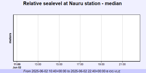 IOC Sea Level Station Monitoring Facility - realtime graph for 'nauu' 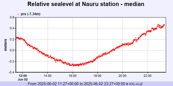 PSMSL Annual Mean Sea Level for '1374' 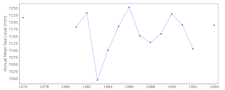 PSMSL Annual Mean Sea Level for '1844' 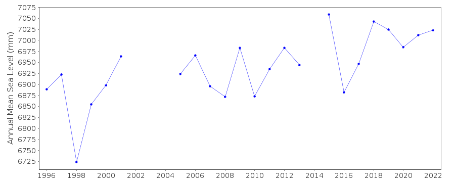 PSMSL Monthly Mean Sea Level for '1844' 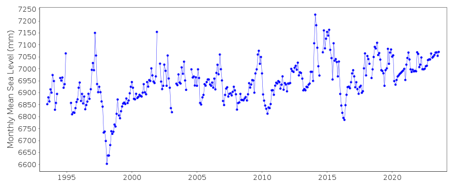
|
|
|