 |
SEALEVEL STATION CATALOG (SSC) |
|
|
|
|
|
| Station catalog metadata [edit] | [station overview] |
|---|
| SSC ID | SSC-mala | | Station Name | Malakal | | Country | Palau | | Latitude | 7.3282 | | Longitude | 134.4502 | | DateLastModified | 2015-10-22 19:02:29 |
| Linked codes |
|---|
| Codes | Location | Latitude | Longitude | Sensors | IOC: mala | Malakal | 7.3282 | 134.4502 | rad, prs, ra2, bat, sw1, sw2, ra3 |
GLOSS: 120 | Malakal | 7.33333 | 134.46666 | Float |
UHSLC: 7 | Malakal | 7.32852 | 134.45013 | N/A |
PTWC: mala | Malakal_Koror_PW | 7.3282 | 134.4502 | prs, ra2, ra3, rad |
PSMSL: 1252 | MALAKAL-B | 7.333333 | 134.466667 | N/A |
PSMSL: 338 | MALAKAL-A | 7.333333 | 134.483333 | N/A |
SONEL_GPS: 2628 | MALAKAL | 7.32815808 | 134.45023633 | N/A |
SONEL_TG: 2627 | MALAKAL | 7.32820000 | 134.45020000 | N/A |
| Distributed metadata source: IOC Sea Level Station Monitoring Facility mala |
|---|
| GTS station code | 300434066948590 |
| GTS message type | SZXX01 |
| Status | Operational |
| Other Contact | University of Hawaii Sea Level Center ( USA ) |
| Connection | GTS message |
| Country | Palau Islands |
| Sensor 1 | |
| Type of sensor | rad |
| Sampling rate (min) | 1 |
| Sensor 2 | |
| Type of sensor | prs |
| Sampling rate (min) | 1 |
| Sensor 3 | |
| Type of sensor | ra2 |
| Sampling rate (min) | 1 |
| Sensor 4 | |
| Type of sensor | bat |
| Sampling rate (min) | 5 |
| Sensor 5 | |
| Type of sensor | sw1 |
| Sampling rate (min) | 60 |
| Sensor 6 | |
| Type of sensor | sw2 |
| Sampling rate (min) | 60 |
| Sensor 7 | |
| Type of sensor | ra3 |
| Sampling rate (min) | 1 |
| Distributed metadata source: GLOSS Station Handbook |
|---|
| Time Zone | 135E, GMT + 9hrs | | Ocean | Pacific | | Operational | Yes | | Tide gauge benchmarks | USGS1 standard brass disc, stamped 'No 1 1969', set in concrete slab at entrance to tide house, a south end of Fisheries Development Wharf (established 13 May 1969) | | Auxiliary benchmarks | USGS2: standard brass disc, stamped 'No 2 1969', set in concrete step platform at E entrance to Fish. Dev. Reefer Plant, about 2.5ft above ground level (USGS2 & 3 established 13 May 1969).
USGS3: standard brass disc stamped 'No 3 1969', set in concrete 2ftx3ft and projecting 1.5ft above ground level located at NE end of 11ft x70ft concrete cooling tank just N of Fish. Dev. Plant.
| | Other relevant information | Other benchmarks:
USGS4: standard brass disc, stamped 'NO 4 1969' set in concrete at S end of sliding door entrance to Malakal Supply Warehouse.
USGS5: standard brass disc, stamped 'NO 5 1969' set in concrete foundation supporting marine railway at Palau shipyard.
AGS3: standard US Navy Hydrographic brass disc stamped'BM #3 USS TANNER'located on top of sea wall 41ft W of tide house, (established Nov 1984).
| | Other relevant codes | UHSLC 007 |
| Distributed metadata source: PTWC COMP META file |
| DCP ID | 300434066948590 |
| WMO | SZXX01 |
| Samp Rate | 1 |
| Num# Samp | 5 |
| Unit | M |
| Scale | 1.0000 |
| Xmt Int. | 005 |
| Fst Min. | 0001 |
| HAR | 1 |
| Owner | UHSLC |
| Distributed metadata source: UHSLC |
| UHSLC id | 007 |
| SSC id | mala |
| GLOSS id | 120 |
| UHSLC geojson | https://uhslc.soest.hawaii.edu/data/meta.geojson |
| Research quality data version a | 1926-01-01 - 1939-12-10 |
| Research quality data version b | 1969-05-18 - 2024-12-31 |
| RQ basin | pacific |
| Fast delivery | 1969-05-18 - 2026-05-31 |
| Distributed metadata source: PSMSL |
| Name | MALAKAL-B |
| GLOSS id | 120 |
| UHSLC ID | 7 |
| SONEL id | 4250 |
| Is RLR | Y |
| Has RLR Diagram | Y link |
| QC Flag | N |
| Old ID | 711/021 |
| Last Updated | 2020-01-28 |
| Supplier | UNIVERSITY OF HAWAII SEA LEVEL CENTER |
| Address | University of Hawaii Sea Level Center, Department of Oceanography Division of Natural Sciences, 1000 Pope Road, Honolulu, Hawaii 96822, UNITED STATES |
| Metric Start | 1969 |
| Metric End | 2018 |
| Metric Completeness | 96.0 |
| RLR Start | 1969 |
| RLR End | 2018 |
| RLR Completeness | 96.0 |
| Download metric sea level data. | Use only with extreme caution. |
| Name | MALAKAL-A |
| GLOSS id | 120 |
| UHSLC ID | 7 |
| Is RLR | N |
| Has RLR Diagram | N link |
| QC Flag | N |
| Old ID | 711/022 |
| Last Updated | 2013-10-14 |
| Supplier | UNIVERSITY OF HAWAII SEA LEVEL CENTER |
| Address | University of Hawaii Sea Level Center, Department of Oceanography Division of Natural Sciences, 1000 Pope Road, Honolulu, Hawaii 96822, UNITED STATES |
| Metric Start | 1926 |
| Metric End | 1939 |
| Metric Completeness | 92.3 |
| Download metric sea level data. | Use only with extreme caution. |
IOC Sea Level Station Monitoring Facility - realtime graph for 'mala' 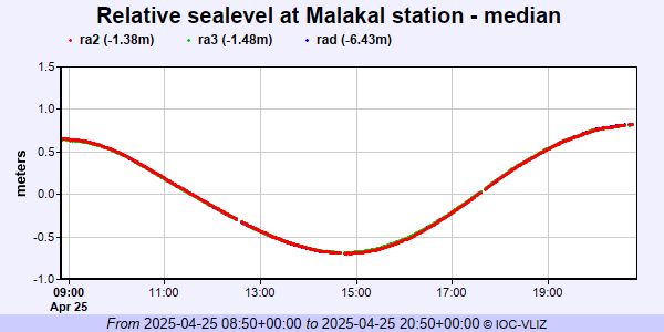 PSMSL Annual Mean Sea Level for '1252'  PSMSL Annual Mean Sea Level for '338'  PSMSL Monthly Mean Sea Level for '338' 
|
|
|