 |
SEALEVEL STATION CATALOG (SSC) |
|
|
|
|
|
| Station catalog metadata [edit] | [station overview] |
|---|
| SSC ID | SSC-kats | | Station Name | Katsuura | | Country | Japan | | Latitude | 35.129444 | | Longitude | 140.249444 | | DateLastModified | 2015-10-22 19:02:29 |
| Distributed metadata source: PSMSL |
| Name | KATSUURA |
| SONEL id | 778 |
| Is RLR | Y |
| Has RLR Diagram | Y link |
| QC Flag | N |
| Old ID | 642/055 |
| Last Updated | 2026-04-07 |
| Supplier | GEOGRAPHICAL SURVEY INSTITUTE |
| Address | Geographical Survey Institute, Kitasato -1, Tsukuba-shi, Ibaraki-ken 305, JAPAN |
| Metric Start | 1967 |
| Metric End | 2025 |
| Metric Completeness | 97.3 |
| RLR Start | 1967 |
| RLR End | 2025 |
| RLR Completeness | 97.3 |
| Download metric sea level data. | Use only with extreme caution. |
PSMSL Annual Mean Sea Level for '1191' 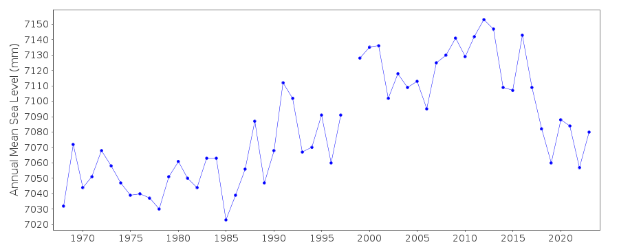 PSMSL Monthly Mean Sea Level for '1191' 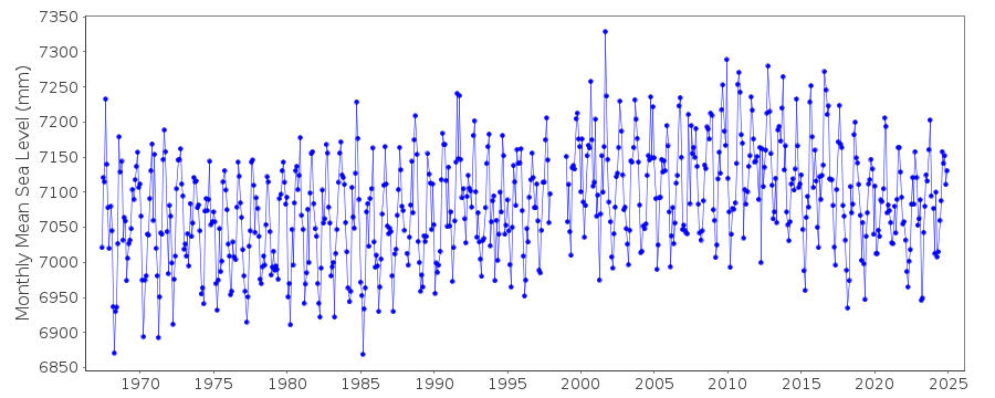
|
|
|