 |
SEALEVEL STATION CATALOG (SSC) |
|
|
|
|
|
| Station catalog metadata [edit] | [station overview] |
|---|
| SSC ID | SSC-geds | | Station Name | Gedser | | Country | Denmark | | Latitude | 54.572778 | | Longitude | 11.925556 | | DateLastModified | 2015-10-22 19:02:29 |
| Distributed metadata source: IOC Sea Level Station Monitoring Facility geds |
|---|
| Status | Operational |
| Local Contact | Danish Meteorological Institute ( Denmark ) |
| Connection | FTP box |
| Country | Denmark |
| Sensor 1 | |
| Type of sensor | rad |
| Sampling rate (min) | 10 |
| Distributed metadata source: UHSLC |
| UHSLC id | 837 |
| SSC id | geds |
| UHSLC geojson | https://uhslc.soest.hawaii.edu/data/meta.geojson |
| Research quality data version a | 1891-09-01 - 2012-12-31 |
| RQ basin | atlantic |
| Distributed metadata source: PSMSL |
| Name | GEDSER |
| UHSLC ID | 837 |
| SONEL id | 2063 |
| Is RLR | Y |
| Has RLR Diagram | Y link |
| QC Flag | N |
| Old ID | 130/001 |
| Last Updated | 2018-11-27 |
| Supplier | DET. DANSKE METEOROLOGISKE INSTITUT |
| Address | Det Danske Meteorologiske Institut, Observation Department, Operations Division, Lyngbyvej 100, DK-2100 Kobenhavn, DENMARK |
| Metric Start | 1892 |
| Metric End | 2017 |
| Metric Completeness | 99.2 |
| RLR Start | 1892 |
| RLR End | 2017 |
| RLR Completeness | 99.2 |
| Download metric sea level data. | Use only with extreme caution. |
IOC Sea Level Station Monitoring Facility - realtime graph for 'geds' 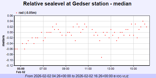 PSMSL Annual Mean Sea Level for '120' 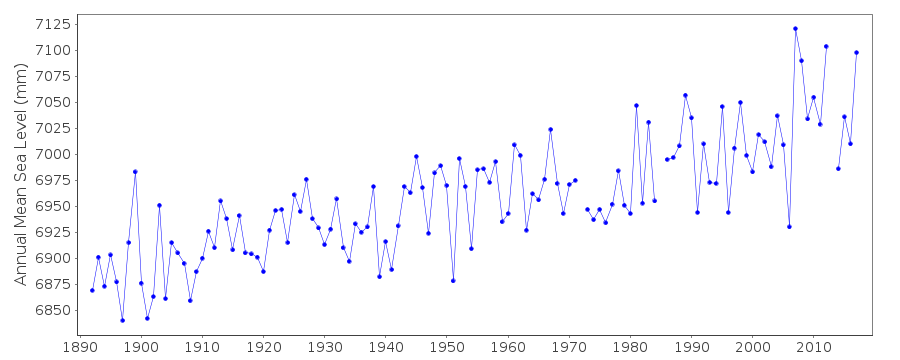 PSMSL Monthly Mean Sea Level for '120' 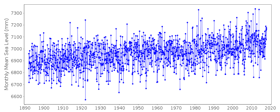
|
|
|