 |
SEALEVEL STATION CATALOG (SSC) |
|
|
|
|
|
| Station catalog metadata [edit] | [station overview] |
|---|
| SSC ID | SSC-doug | | Station Name | Douglas | | Country | Isle of Man | | Latitude | 54.15 | | Longitude | -4.466667 | | DateLastModified | 2015-10-22 19:02:29 |
| Linked codes |
|---|
| Codes | Location | Latitude | Longitude | Sensors | PSMSL: 435 | DOUGLAS | 54.15 | -4.466667 | N/A |
| Distributed metadata source: PSMSL |
| Name | DOUGLAS |
| Is RLR | Y |
| Has RLR Diagram | Y link |
| QC Flag | N |
| Old ID | 170/231 |
| Last Updated | 1992-04-07 |
| Supplier | ISLE OF MAN HARBOUR BOARD |
| Address | Isle of Man Harbour Board, Engineers Office, Douglas, Isle of Man, ISLE OF MAN |
| Metric Start | 1938 |
| Metric End | 1977 |
| Metric Completeness | 85.8 |
| RLR Start | 1938 |
| RLR End | 1977 |
| RLR Completeness | 85.8 |
| Download metric sea level data. | Use only with extreme caution. |
PSMSL Annual Mean Sea Level for '435' 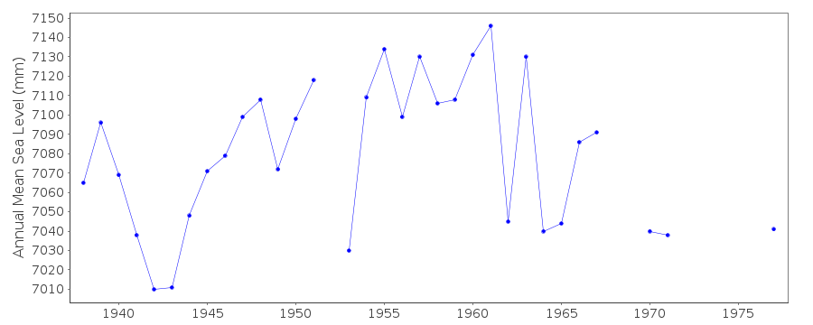 PSMSL Monthly Mean Sea Level for '435' 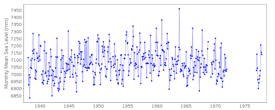
|
|
|