 |
SEALEVEL STATION CATALOG (SSC) |
|
|
|
|
|
| Station catalog metadata [edit] | [station overview] |
|---|
| SSC ID | SSC-corr | | Station Name | Corral | | Country | Chile | | Latitude | -39.8865805 | | Longitude | -73.426133 | | DateLastModified | 2015-10-22 19:02:29 |
| Distributed metadata source: IOC Sea Level Station Monitoring Facility corr |
|---|
| GTS station code | 14066424 |
| GTS message type | SXCH40 |
| Status | Operational |
| Local Contact | Servicio Hidrográfico y Oceanográfico de la Armada ( Chile ) |
| Other Contact | Servicio Hidrográfico y Oceanográfico de la Armada ( Chile ) |
| Connection | GTS message |
| Country | Chile |
| Sensor 1 | |
| Type of sensor | prs |
| Sampling rate (min) | 1 |
| Sensor 2 | |
| Type of sensor | rad |
| Sampling rate (min) | 1 |
| Distributed metadata source: IOC Sea Level Station Monitoring Facility corr2 |
|---|
| Status | Operational |
| Local Contact | Servicio Hidrográfico y Oceanográfico de la Armada ( Chile ) |
| Other Contact | Servicio Hidrográfico y Oceanográfico de la Armada ( Chile ) |
| Connection | WEB service |
| Country | Chile |
| Sensor 1 | |
| Type of sensor | prs |
| Sampling rate (min) | 1 |
| Sensor 2 | |
| Type of sensor | rad |
| Sampling rate (min) | 1 |
| Distributed metadata source: PTWC COMP META file |
| DCP ID | 14066424 |
| WMO | SXCH40 |
| Samp Rate | 1 |
| Num# Samp | 5 |
| Unit | M |
| Scale | 1.0000 |
| Xmt Int. | 005 |
| Fst Min. | 0001 |
| HAR | 1 |
| Owner | SHOA |
| Distributed metadata source: PSMSL |
| Name | CORRAL |
| SONEL id | 2654 |
| Is RLR | Y |
| Has RLR Diagram | Y link |
| QC Flag | N |
| Old ID | 850/047 |
| Last Updated | null |
| Supplier | HYDROGRAPHIC AND OCEANOGRAPHIC SERVICE OF THE CHILEAN NAVY |
| Address | Hydrographic and Oceanographic Service of the Chilean Navy, Errazuriz 254, Playa Ancha , Valparaiso, CHILE |
| Metric Start | 1963 |
| Metric End | 1964 |
| Metric Completeness | 100.0 |
| RLR Start | 1963 |
| RLR End | 1964 |
| RLR Completeness | 100.0 |
| Download metric sea level data. | Use only with extreme caution. |
| Name | CORRAL II |
| SONEL id | 2654 |
| Is RLR | Y |
| Has RLR Diagram | Y link |
| QC Flag | N |
| Old ID | 850/048 |
| Last Updated | 2025-06-09 |
| Supplier | HYDROGRAPHIC AND OCEANOGRAPHIC SERVICE OF THE CHILEAN NAVY |
| Address | Hydrographic and Oceanographic Service of the Chilean Navy, Errazuriz 254, Playa Ancha , Valparaiso, CHILE |
| Metric Start | 1985 |
| Metric End | 2024 |
| Metric Completeness | 89.0 |
| RLR Start | 1985 |
| RLR End | 2024 |
| RLR Completeness | 89.0 |
| Download metric sea level data. | Use only with extreme caution. |
IOC Sea Level Station Monitoring Facility - realtime graph for 'corr' 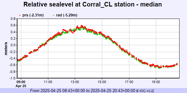 IOC Sea Level Station Monitoring Facility - realtime graph for 'corr2' 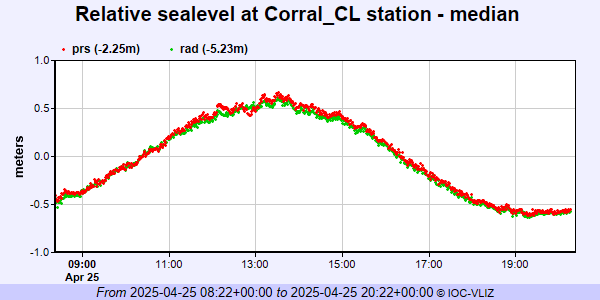 PSMSL Annual Mean Sea Level for '1057' 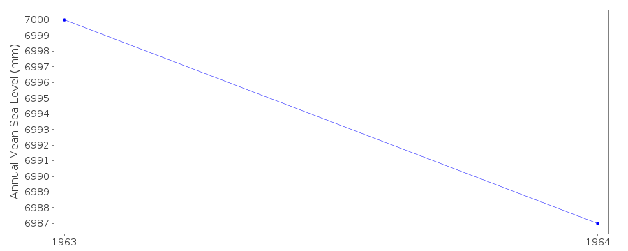 PSMSL Annual Mean Sea Level for '2262' 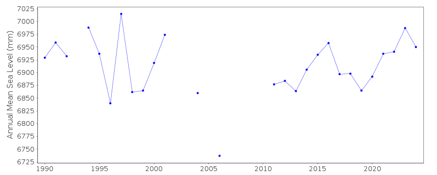 PSMSL Monthly Mean Sea Level for '2262' 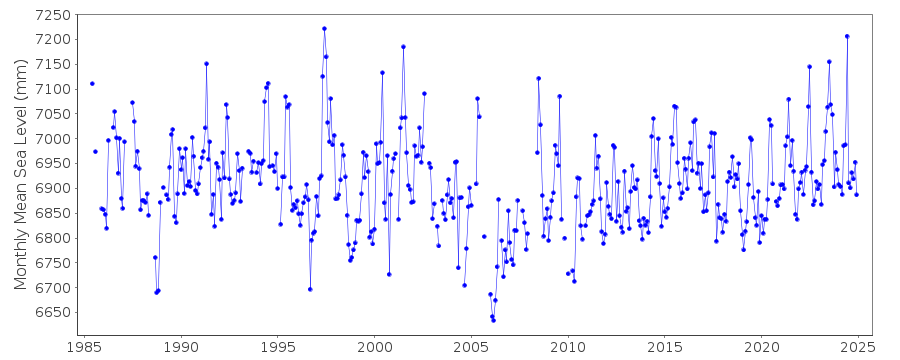
|
|
|