 |
SEALEVEL STATION CATALOG (SSC) |
|
|
|
|
|
| Station catalog metadata [edit] | [station overview] |
|---|
| SSC ID | SSC-buve | | Station Name | Buenaventura | | Country | Colombia | | Latitude | 3.8906 | | Longitude | -77.0808 | | DateLastModified | 2015-10-22 19:02:29 |
| Linked codes |
|---|
| Codes | Location | Latitude | Longitude | Sensors | IOC: buve | Buenaventura | 3.8906 | -77.0808 | rad, bub |
IOC: buve2 | Buenaventura | 3.8906 | -77.0808 | rad, bub |
IOC: buve3 | Buenaventura, Maritime signalling pier | 3.8883833 | -77.0443726 | rad, ra2, atm, bat |
GLOSS: 170 | Buenaventura | 3.9 | -77.1 | Float |
UHSLC: 85 | Buenaventura | 3.89 | -77.0617 | N/A |
PTWC: buv3 | Buenaventura_CO | 3.8884 | -77.0444 | rad1, rad2 |
PTWC: buve | Buenaventura_CO | 3.8906 | -77.0808 | rad, prs |
PSMSL: 456 | BUENAVENTURA | 3.9 | -77.1 | N/A |
SONEL_GPS: 2046 | BUENAVENTURA | 3.88202245 | -77.01042064 | N/A |
SONEL_TG: 2393 | BUENAVENTURA | 3.89060000 | -77.08080000 | N/A |
| Distributed metadata source: IOC Sea Level Station Monitoring Facility buve |
|---|
| GTS station code | 15AA92C8 |
| GTS message type | SXCO41 |
| Status | Operational |
| Local Contact | Dirección General Marítima ( Colombia ) |
| Connection | FTP box |
| Country | Colombia |
| Sensor 1 | |
| Type of sensor | rad |
| Sampling rate (min) | 2 |
| Sensor 2 | |
| Type of sensor | bub |
| Sampling rate (min) | 2 |
| Distributed metadata source: IOC Sea Level Station Monitoring Facility buve2 |
|---|
| GTS station code | 15AA92C8 |
| GTS message type | SXCO41 |
| Status | Operational |
| Local Contact | Dirección General Marítima ( Colombia ) |
| Connection | GTS message |
| Country | Colombia |
| Sensor 1 | |
| Type of sensor | rad |
| Sampling rate (min) | 1 |
| Sensor 2 | |
| Type of sensor | bub |
| Sampling rate (min) | 1 |
| Distributed metadata source: IOC Sea Level Station Monitoring Facility buve3 |
|---|
| GTS station code | 6B004E92 |
| GTS message type | SXCO41 |
| Status | Operational |
| Local Contact | Dirección General Marítima ( Colombia ) |
| Other Contact | National Oceanography Centre ( UK ) |
| Connection | GTS message |
| Country | Colombia |
| Sensor 1 | |
| Type of sensor | rad |
| Sampling rate (min) | 1 |
| Sensor 2 | |
| Type of sensor | ra2 |
| Sampling rate (min) | 1 |
| Sensor 3 | |
| Type of sensor | atm |
| Sampling rate (min) | 5 |
| Sensor 4 | |
| Type of sensor | bat |
| Sampling rate (min) | 5 |
| Distributed metadata source: GLOSS Station Handbook |
|---|
| Time Zone | 075W, GMT - 5hrs | | Ocean | Pacific | | Operational | Yes | | Responsible country | Colombia | | Additional parameters | Sea temperature, sea salinity,sea density | | Tide gauge benchmarks | BM 1 FT 277 located in NW corner of platform (a 6.122 mts. del cero de la regla (limnimetro);
CMB 10 a 5.514 mts. Del cero de la regla (LM);
CMB 11 a 7.678 mts. Del cero de la regla (LM).
| | Benchmark relationships | CMB 12 a 7.453 mts. Del cero de la regla (LM).
CMB 13 a 7.951 mts. Del cero de la regla (LM).
| | Auxiliary benchmarks | CMB-1B a 6.093 mts. Del cero de la regla (LM) | | Other relevant information | 1942-1989 standard tide gauge;
1989 replaced with Fisher Porter analogue to digital recorder (ADR).
| | Other relevant codes | UHSLC 085 | | Nearest Met. station | Colpuertos 1969-04 |
| Distributed metadata source: PTWC COMP META file |
| DCP ID | 6B004E92 |
| WMO | SXCO41 |
| Samp Rate | 1 |
| Num# Samp | 5 |
| Unit | M |
| Scale | 1.0000 |
| Xmt Int. | 005 |
| Fst Min. | 0001 |
| HAR | 0 |
| Owner | DGM |
| Distributed metadata source: UHSLC |
| UHSLC id | 085 |
| SSC id | buve |
| GLOSS id | 170 |
| UHSLC geojson | https://uhslc.soest.hawaii.edu/data/meta.geojson |
| Research quality data version a | 1953-05-12 - 2014-12-31 |
| RQ basin | pacific |
| Distributed metadata source: PSMSL |
| Name | BUENAVENTURA |
| GLOSS id | 170 |
| UHSLC ID | 85 |
| SONEL id | 2046 |
| Is RLR | Y |
| Has RLR Diagram | Y link |
| QC Flag | N |
| Old ID | 842/011 |
| Last Updated | 2015-11-04 |
| Supplier | I.D.E.A.M., COLOMBIA |
| Address | I.D.E.A.M., Carrera 5a, No.15-80 Piso 18, Aa 18633 Santafe de Bogota Dc, COLOMBIA |
| Metric Start | 1941 |
| Metric End | 2014 |
| Metric Completeness | 90.1 |
| RLR Start | 1941 |
| RLR End | 1969 |
| RLR Completeness | 90.8 |
| Download metric sea level data. | Use only with extreme caution. |
IOC Sea Level Station Monitoring Facility - realtime graph for 'buve' 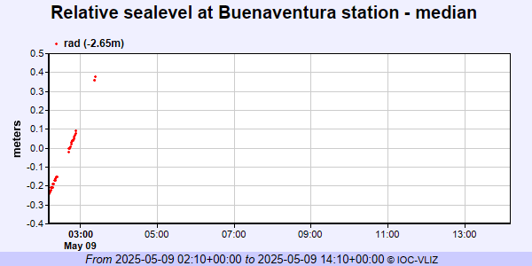 IOC Sea Level Station Monitoring Facility - realtime graph for 'buve2' 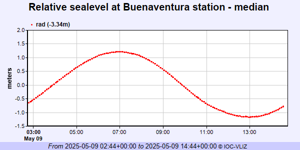 IOC Sea Level Station Monitoring Facility - realtime graph for 'buve3'  PSMSL Annual Mean Sea Level for '456' 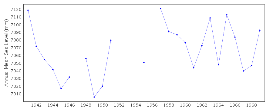 PSMSL Monthly Mean Sea Level for '456' 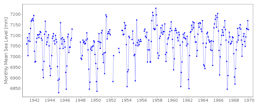
|
|
|