 |
SEALEVEL STATION CATALOG (SSC) |
|
|
|
|
|
| Station catalog metadata [edit] | [station overview] |
|---|
| SSC ID | SSC-bourk | | Station Name | Bourgas | | Country | Bulgaria | | Latitude | 42.483333 | | Longitude | 27.483333 | | DateLastModified | 2015-10-22 19:02:29 |
| Linked codes |
|---|
| Codes | Location | Latitude | Longitude | Sensors | PSMSL: 317 | BOURGAS | 42.483333 | 27.483333 | N/A |
| Distributed metadata source: PSMSL |
| Name | BOURGAS |
| Is RLR | Y |
| Has RLR Diagram | Y link |
| QC Flag | N |
| Old ID | 295/021 |
| Last Updated | 1997-08-27 |
| Supplier | MIN. OF REGIONAL DEV. AND CONSTRUCTION |
| Address | Min. of Regional Dev. and Construction, Research Institute of Geodesy and Photogrammetry, 1 Moussala Str., 1618 Sofia, BULGARIA |
| Metric Start | 1928 |
| Metric End | 1996 |
| Metric Completeness | 85.4 |
| RLR Start | 1929 |
| RLR End | 1996 |
| RLR Completeness | 86.3 |
| Download metric sea level data. | Use only with extreme caution. |
PSMSL Annual Mean Sea Level for '317' 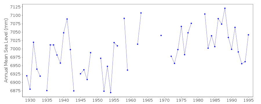 PSMSL Monthly Mean Sea Level for '317' 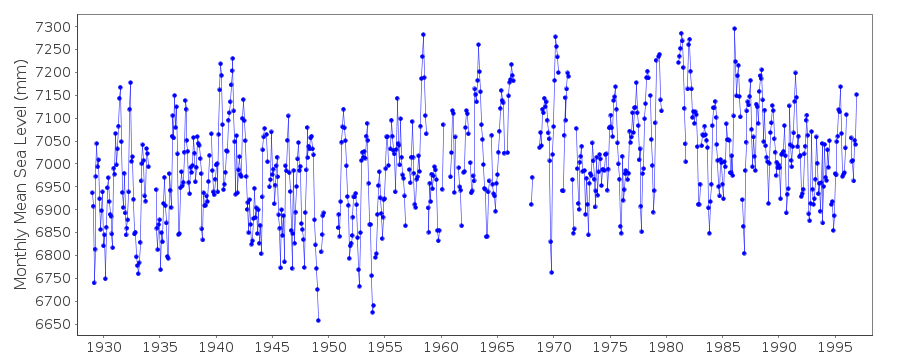
|
|
|