 |
SEALEVEL STATION CATALOG (SSC) |
|
|
|
|
|
| Station catalog metadata [edit] | [station overview] |
|---|
| SSC ID | SSC-barag | | Station Name | Baracoa | | Country | Cuba | | Latitude | 20.35 | | Longitude | -74.5 | | DateLastModified | 2015-10-22 19:02:29 |
| Linked codes |
|---|
| Codes | Location | Latitude | Longitude | Sensors | PSMSL: 592 | BARACOA | 20.35 | -74.5 | N/A |
| Distributed metadata source: PSMSL |
| Name | BARACOA |
| Is RLR | Y |
| Has RLR Diagram | Y link |
| QC Flag | N |
| Old ID | 930/041 |
| Last Updated | 2025-07-18 |
| Supplier | NEGOCIADO DE HIDROGRAFIA, HAVANA, CUBA |
| Address | Negociado de Hidrografia, Havana, CUBA |
| Metric Start | 1949 |
| Metric End | 2024 |
| Metric Completeness | 6.1 |
| RLR Start | 1949 |
| RLR End | 2024 |
| RLR Completeness | 6.1 |
| Download metric sea level data. | Use only with extreme caution. |
PSMSL Annual Mean Sea Level for '592' 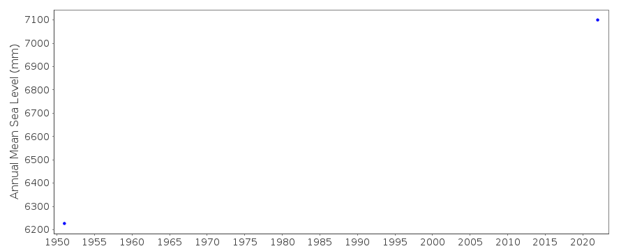 PSMSL Monthly Mean Sea Level for '592' 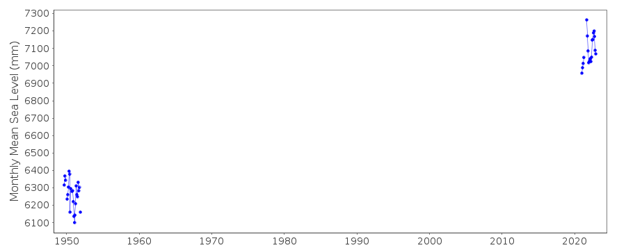
|
|
|