 |
SEALEVEL STATION CATALOG (SSC) |
|
|
|
|
|
| Station catalog metadata [edit] | [station overview] |
|---|
| SSC ID | SSC-aler | | Station Name | Alert | | Country | Canada | | Latitude | 82.49 | | Longitude | -62.32 | | DateLastModified | 2015-10-22 19:02:29 |
| Distributed metadata source: IOC Sea Level Station Monitoring Facility aler |
|---|
| Status | Operational |
| Local Contact | Fisheries and Oceans Canada ( Canada ) |
| Connection | WEB service |
| Country | Canada |
| Sensor 1 | |
| Type of sensor | prs |
| Sampling rate (min) | 1 |
| Distributed metadata source: GLOSS Station Handbook |
|---|
| Time Zone | GMT -5hrs | | Data acquisition rate | Sampling at 3 minute interval | | Auxiliary benchmarks | Gauge type: Bubbler system, Telephone modem, 3 minute data, download daily. | | Other relevant information | Proposed as replacement for GLOSS 153. GLOSS ID153 has not been in operation since 1994, it is unlikely the station will be re-activated.
Has GPS.
Gauge re-established December 2002.
Daily transmission of data to ISDM |
| Distributed metadata source: UHSLC |
| UHSLC id | 836 |
| SSC id | aler |
| GLOSS id | 333 |
| UHSLC geojson | https://uhslc.soest.hawaii.edu/data/meta.geojson |
| Fast delivery | 2018-09-01 - 2024-01-01 |
| Distributed metadata source: PSMSL |
| Name | ALERT |
| GLOSS id | 333 |
| UHSLC ID | 836 |
| SONEL id | 625 |
| Is RLR | Y |
| Has RLR Diagram | Y link |
| QC Flag | N |
| Old ID | 970/162 |
| Last Updated | 2025-06-19 |
| Supplier | CANADIAN HYDROGRAPHIC SERVICE |
| Address | Canadian Hydrographic Service, 615 Booth Street, Ottawa , Ontario K1A 0E6, CANADA |
| Metric Start | 1965 |
| Metric End | 2024 |
| Metric Completeness | 35.7 |
| RLR Start | 1965 |
| RLR End | 2024 |
| RLR Completeness | 35.7 |
| Download metric sea level data. | Use only with extreme caution. |
IOC Sea Level Station Monitoring Facility - realtime graph for 'aler'  PSMSL Annual Mean Sea Level for '1110' 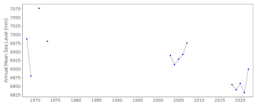 PSMSL Monthly Mean Sea Level for '1110' 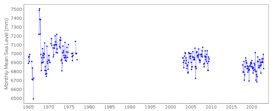
|
|
|