 |
SEALEVEL STATION CATALOG (SSC) |
|
|
|
|
|
| Station catalog metadata [edit] | [station overview] |
|---|
| SSC ID | SSC-aarh | | Station Name | Aarhus | | Country | Denmark | | Latitude | 56.147222 | | Longitude | 10.223889 | | DateLastModified | 2015-10-22 19:02:29 |
| Linked codes |
|---|
| Codes | Location | Latitude | Longitude | Sensors | IOC: aarh | Aarhus | 56.15 | 10.22 | rad |
PSMSL: 76 | AARHUS | 56.147222 | 10.223889 | N/A |
| Distributed metadata source: IOC Sea Level Station Monitoring Facility aarh |
|---|
| Status | Operational |
| Local Contact | Danish Meteorological Institute ( Denmark ) |
| Connection | FTP box |
| Country | Denmark |
| Sensor 1 | |
| Type of sensor | rad |
| Sampling rate (min) | 10 |
| Distributed metadata source: PSMSL |
| Name | AARHUS |
| SONEL id | 4423 |
| Is RLR | Y |
| Has RLR Diagram | Y link |
| QC Flag | N |
| Old ID | 130/081 |
| Last Updated | 2018-11-27 |
| Supplier | DET. DANSKE METEOROLOGISKE INSTITUT |
| Address | Det Danske Meteorologiske Institut, Observation Department, Operations Division, Lyngbyvej 100, DK-2100 Kobenhavn, DENMARK |
| Metric Start | 1888 |
| Metric End | 2017 |
| Metric Completeness | 97.8 |
| RLR Start | 1888 |
| RLR End | 2017 |
| RLR Completeness | 97.1 |
| Download metric sea level data. | Use only with extreme caution. |
IOC Sea Level Station Monitoring Facility - realtime graph for 'aarh' 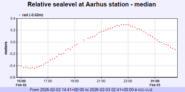 PSMSL Annual Mean Sea Level for '76' 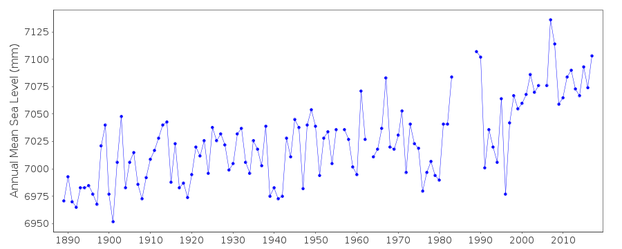 PSMSL Monthly Mean Sea Level for '76' 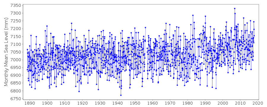
|
|
|